After
Elk Mountain kicked our asses we've been going on big hikes every weekend in an effort to get back in shape. The weekend after Elk, I took on
Hamilton Mountain with a friend for a solid 8 miles and 2200 feet of climbing. After Elk Mountain's bullshit, Hamilton was a piece of cake. I was more or less showing my friend the hike so I didn't take many pictures and since I've already made a solid entry here I didn't bother posting on it.
The weekend after that, me and Keeley took on
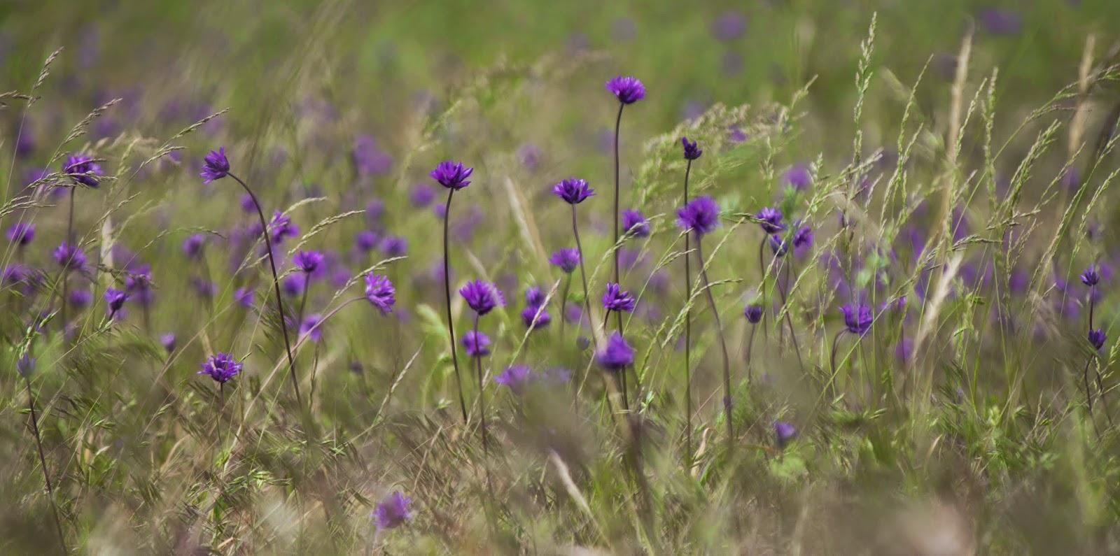
Dog Mountain to see the wildflower bloom. We got another 8 miles and 2800 feet of elevation gain, but it was hard. Probably harder than our first go-round, for me. The first mile of Dog is just murder in the first, and it remains at least manslaughter all the way up. At the lower viewpoint I took out my camera to get pictures of the wildflower bloom (spectacular as always) only to find out I had left the camera battery charging at home. So I was lugging a DSLR and two extra lenses on my back for literally nothing and couldn't get high quality flower pictures. Keeley used her iPhone and we got what we could. Dog Mountain is still worth it for the top meadows, but with how stupid popular it is and how unrelentingly unfun most of the climb is I'd say this time didn't blow me away as much as the first time.
 |
| Pano from Dog Mountain summit |
 |
| Flower Meadows |
 |
| Wind Mtn, with Table way in the back. |
 |
| The final flower meadows |
 |
| Feet pointing towards the Wind and Shellrock mtn gateway |
So this weekend we wanted to do another tough one, but since it was Memorial Day weekend I wanted to pick one that wouldn't be too crowded. We settled on Starvation Ridge.
We lightly touched Starvation Ridge once before. That time we only meant to do the lower waterfall loop but accidentally climbed to the powerline crest and slightly beyond before turning around and doing the loop. This time was different. This time we wanted to climb the whole ridge all the way to Warren Lake. This is part of the Starvation/Mt. Defiance loop, and it would be a great test to see how well we are doing fitness wise. If we could make it to the lake, we are doing good this year. Spoiler alert, we made it to the lake, and it was probably my favorite hike of the year, possibly top 5 total for me.
The hike on OregonHikers field guide is listed at 6.2 miles out and back. That is a big fat lie. Google also lies. On google maps you climb up the ridge most of the way, then before a big mountain at the peak you cut to the right and up to the lake, but there is also a long way around the back. The long way is the only trail that actually exists. Obviously. So the trail is actually 9 miles total, with 3900 feet of elevation gain, a full 1000+ feet more than Dog Mtn. This is the first real, true challenge of our hiking year.
The hike starts at the Starvation Creek trailhead right next to the highway, directly across the river from Dog Mountain. We got started at about 11, kinda late, and Dog Mountain's summit was still stuck in the clouds. I felt bad for all the suckers up there. Our hike resulted in very little human interaction, despite a full parking lot. I imagine most were doing the lower loop. You parallel the freeway for about a 6th of a mile, then the Starvation Cutoff trail goes off up the cliff from the main trail. For the next 3rd of a mile life is terrible. It's not quite Elk Mountain levels of steep, but it's at least the worst of Dog levels of steep. Thankfully it levels out for a brief stretch before the final brutal .8 mile climb to the Lower Starvation junction.
 |
| Lower viewpoint facing west. Shellrock and Wind stand guard |
 |
| Wind Mountain |
 |
| Dog Mtn with the summit covered in cloud, hahaha suckers |
 |
| Lower viewpoint on Dog Mtn, look at the tiny people |
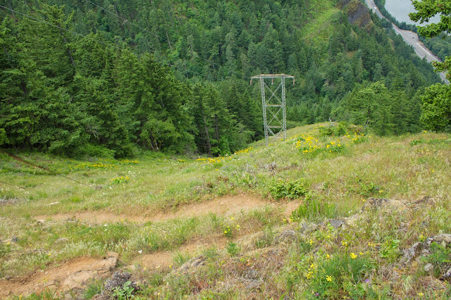
Once at the junction, turn left, go about 100 feet to the first viewpoint, looking west at Wind Mountain, across at Dog, and down to the parking lot if you lean a bit. From here you start switch backing up the power line area. The power line meadows were covered in wildflowers. It wasn't as abundant as dog, but the variety in color was higher. I haven't seen as many different flowers on a hike since Hardy Ridge.
For as tough as it looks from below, you reach the apex of the power line meadows pretty quickly and the incline up isn't terrible. Take in the views from the windy spot though, it'll be the last great view of the trip. From here you follow the top of Starvation Ridge up and up almost due south.
 |
| I need to learn my Wildflowers |
 |
| Purple sprouty flowers |
 |
| Goddamn Poison Oak is everywhere on the initial slopes |
 |
| Purple |
 |
| Pink poof |
 |
| Some Balsamroot |
 |
| Keeley and Dog Mtn from the powerline viewpoint |
 |
| Wind Mtn from powerline VP, getting smaller |
 |
| The slope you climb up to reach the powerline viewpoint, not as bad as it looks |
 |
| The trail up Starvation Ridge begins |
 |
| Purple |
 |
| Beargrass, like a tennis ball sized dandelion. |
 |
| Indian Paintbrush |
 |
| White flower |
The trail up Starvation Ridge is tough, but a treat. The trail stays pretty much right on top the ridgeline, and as such the trail does a lot of little turns and twists, ups and downs, through heavy forest and sunny meadows. The wildflowers litter every sunny spot, and as you climb the predominant flower changes. Balsamroot and a cute purple/blue flower owns the power line meadows. Then into the ridge you see a lot of yellow, red, pink, and purple. Once you get into the higher elevations, Beargrass becomes the prevalent plant.
After several climbing sections and level sections you reach the 2,500 ft viewpoint, facing west. It's the final point you can really see the gorge. Wind Mountain looks significantly smaller than it did from the powerlines. You are about on level with the lower spots of Dog Mountain's peak meadows. But this is practically the halfway point. You still have about 1,500 feet to climb over 2.5 miles. From this spot the hardest section of the trail hits, and you climb a steep section that is more or less on par with the steepest sections of any gorge hike for about a 4th of a mile. But after that, things level out onto a rocky saddle section for a while.
 |
| Wind Mountain from about 2,500 feet. Looking smaller and smaller. |
 |
| The final meadows of Dog Mountain, still cloudy, haha suckers |
 |
| Wind Mountain's summit and the hills behind it |
 |
| Wind Mtn |
One thing I really like about Starvation Ridge is that unlike Dog or other steep hikes, Starvation ridge presents itself as a sort of series of mini-challenges. Dog, Elk, & the final miles of Table all pretty much stay on an upward pitch. Starvation Ridge does not. It has frequent short level sections between the knee breaking climbs, so you can tackle the trail in short bursts of energy that allow you to catch your breath easily. Climb section, slowly enjoy flat area, repeat. All the way up. Since you constantly accomplish these short climbing goals, the climb never really beats your morale. It's actually quite satisfying. Despite climbing higher than Dog, I never once felt half as awful as that hike made me feel.
Once you climb the steep section past the viewpoint, the scenery begins to change. A large hill looms in front of you through the forest. The trail has changed from dry dirt to a very uneven rocky path. There are several talus slopes to the left, remains of old landslides. The trail cuts around the left flank of the big hill in front of you, you cross over a few talus slopes with some mild views, and then you begin the final real challenge of the hike, the 11 switchbacks up the east flank. The switchbacks aren't too steep, but it keeps going. This is about cloud level on gloomier days, and a cloud hadn't yet burned off, so the final few switchbacks were in the mist.
After the switchbacks, you cross a huge talus slope with a stupendous view of Mt Adams, which for us was playing peek-a-boo with the clouds. From here the scenery again takes on a new form, as it looks like a fire tore through here once. The trees are thin and the area is open. And for the first time hiking on the Oregon side of the gorge, I could see south towards Mt. Hood. The area no longer feels like dense gorge jungle, now the scenery has taken on an Alpine feel. It reminded me a lot of hiking the Newberry Volcano south of Bend.
 |
| Green on the way up the ridge |
 |
| Misty Mountain top |
 |
| The talus slope crossing, facing Mt. Adams |
 |
| Mt. Adams looming over the valley (Cook Hill is the middle distance mtn covered in clouds) |
 |
| Trail across the Talus |
 |
| Mt Adams is shy |
You climb up the hill a little more, but then you essentially have one more mile to go over mostly flat alpine land. You get fleeting glimpses of Wind Mountain, which now looks teeny. You also get glimpses of Mt. Defiance, the highest peak of the gorge and part of this trail, but 1 mile and 1000 more feet of climbing beyond you. Another day. After a junction, it's another .3 miles and 100 feet down to Warren Lake, a small alpine lake on the northeast slope of Mt. Defiance. It was quiet, peaceful, warm, and beautifully tranquil. We ate lunch, high fived, and began the long journey home.
 |
| Warren Lake |
 |
| Warren Lake |
 |
| Mt. Defiance from the top of Starvation Ridge. Highest peak in the Gorge. |
Going back down Starvation Ridge sucks. I hope you enjoy knee pain and wondering how on earth you managed to climb this. The worst part though, is that final 4th mile stretch of steep right at the beginning of the trail. Going up is hard. Going down is outright frightening. I'm never going back that way again.
 |
| The Hike as viewed from Google Earth, from roughly halfway up Dog mtn |
 |
| The view of the whole hike from a different Google Earth perspective |
 |
| The hike as viewed from the Panorama from the beginning of this post |
This was the hardest day hike we've ever done. 3900 feet in 9 miles. Table Mountain, last year's big goal, was 8 miles and 3350 feet. We just laughed at that hike. Best of all, outside Mt. Defiance, this was basically on par with most of the "tough" gorge hikes and makes me confident that at this pace we can do all the biggies this year. A look at what's still on our menu:
Ruckle Ridge - 9 miles, 3700 feet
Nesmith Point - 10 miles, 4010 feet
Rock of Ages loop- 10 miles, 3000 feet
Larch mtn - 14 miles, 4010 feet
Franklin ridge - 12 miles, 2700 feet
Wauna Point - 9 miles, 2800 feet
Elevator Shaft - 7ish miles, 1860 feet (climb is entirely straight up a Talus slope)
Mt. Defiance- 11 miles, 4840 feet
Outside Defiance, at our current level I think most of those are pretty doable.