Last year Keeley
saw a post made by the US Department of the Interior on Instagram (
The best Instagram account out there, frankly) featuring a beautiful mysterious image of a place called "Table Rock Wildnerness, Oregon". I'd never heard of it. She wanted to see it. I figured okay. We never made it out there last year, and with this year coming we figured this would be a good time to check it out. We were just a touch late for the fall colors, sadly, but the hike didn't disappoint at all. In fact it was better than I expected.
Table Rock is a big basalt slab in the cascade mountains about 50 miles southeast of Portland in the Table Rock Wilderness, a 6,000 acre area. It's considered part of
The Old Cascades. Table Rock itself is 4,881 feet high. The area has diverse plant life and rhododendrons are
everywhere. I'll have to come back when they are in bloom. The area is supposedly semi-popular but we saw only 1 other couple the entire time we were out during peak hours on saturday. Of course, the forecast was bad and it was already wet, so take that with a grain of salt.
Table rock isn't the easiest place to access. It's not near any major roads, you pretty much leave the Salem area, travel through some farm towns, then take winding backroads through river valleys till you reach the Molalla River recreation area, then drive on a beautiful park road following signs till you reach the final 3 miles, which are on a well maintained gravel road. Despite being 50 miles from Portland it takes just over 90 minutes to reach. The trailhead is a small wide spot on the road with an outhouse and a signboard.
From here you are on the trail, but for the next mile and a half you are actually still on the road. The road beyond the trailhead suffered a lot of washouts during a storm in '96, so the trailhead was moved back. The trail is mostly flat with the occasional stream crossing and one section in the woods to avoid a major washout.
 |
| The old road |
Finally the trail reaches the original trailhead and plunges up into the woods. From here the trail gets kinda steep as it travels through a nice open area under the big evergreens. Surprisingly little undergrowth. You get little views to the north from time to time, and twice the trail passes by at the bottom of a big old former landslide area with big basalt rocks up at the top. You climb up and walk along the side of one of these big rock slabs and then you reach the top of the steepest climb, right behind one of these rocks. A scramble trail leads up the rock and is very much worth checking out as a quality break point. The view is stellar and we got hints of a rainbow.
 |
| Sitting on Little Table Rock |
 |
| Hiking is fun |
 |
| This is why we do it |
 |
| Panorama from Little Table Rock |
 |
| Rainbow to the north |
 |
| facing north |
 |
| Table Rock summit from Little Table rock |
From "little table rock", as I called the spot, you can see the summit looming depressingly far above you. It's only 500 or so feet in elevation higher, but it looks way worse. You've actually done the hardest part to get to little table rock. From here the trail goes back into the forest for a brief stretch with mild climbing until all of a sudden the trees open up and you are at the foot of the massive columnar basalt walls in an amazing ampitheatre. It also gives a good echo. Keeley took a vine:
You travel along the landslide, actually going downhill to get around the biggest wall. At one point the trail has a small fresh landslide that must be extremely recent because each step resulted in a slide and nothing had settled yet. Pass that, look at the cool notch in the walls, and then you pass around the wall and begin to climb the backside of the rock. The trail gets a bit steeper and climbs for a while till you reach a campsite.
 |
| Rock Walls in the mist |
 |
| Table rock columnar basalt wall in the mist |
 |
| Large notch in the basalt |
 |
| Landslide on the trail |
From the campsite you have several options. Turn immediately left and you see a sign for the Table Rock summit trail. Turn immediately right, and climb up a short steep rocky climb to a must see little viewpoint of Table Rock itself. Go straight and right and you are on the saddle trail which goes a mile or two south to Chicken Rock, a future hike plan for us. We headed up the summit.
 |
| The saddle campsite junction |
 |
| Sign is pretty fresh |
 |
| Seen on the way back down, view from saddle viewpoint |
 |
| Table rock from the short path from the saddle campsite |
 |
| Table rock facing north |
 |
| Heading up Table Rock |
One switchback and some medium steep and all of a sudden the world opens up and you are on the exposed top of Table rock. A quick jaunt to the north and you are at the top. The clouds were closing in but we could see the bottom of both Mt. Hood and Mt. Jefferson. We settled in, ate a cliff bar, and that's when the rain hit. The stellar view of 5 minutes ago was now completely gone as the cloud settled in on us and the drizzle heated up. We tried to wait it out under some trees at the summit campsite, but it didn't look to be getting better so we headed back, hitting the campsite viewpoint on the way. The trail was now covered in mist and cloud and it was really neat, we felt extremely lucky because it never stopped raining for the rest of the day and it was clear we beat the rain to the top by mere minutes. Any later and we wouldn't have had nearly the same experience. The Hike was about 7.5 miles and 2000 feet of elevation gain.
 |
| Add caption |
 |
| Mt. Hood looms under the low clouds |
 |
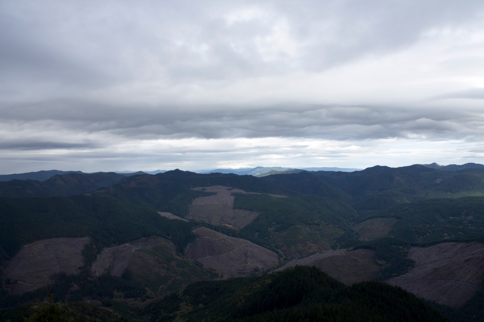
| facing southeast |
 |
| foothills of the cascades |
 |
| Technically Mt. Jefferson is in this picture if you can see it |
 |
| Looking down at little table rock |
 |
| Panorama from the top |
 |
| Keeley as the rain begins to hit |
 |
| 5 minutes after reaching the summit everything is in clouds and visibility is zero |
 |
| heading back during a brief cloud break |
 |
| on the way back |
There are to more meaningful hikes in the area. One is going to Chicken Rock/Rooster Rock from the Table campsite, which is a 10 mile out and back. If you get there early and have plenty of supplies, a third option is a 14 mile loop that comes in from further east and hits both spots. Maybe one day.