Pages

Sunday, March 29, 2015

Two Chiefs

Two weeks ago a friend came into town for his birthday and requested a hike. We took him to Elowah. The next week we went straight back to Elowah to go on a big group hike with some of Keeley's co-workers. That makes Elowah officially my most visited hike. I love that place but I probably won't go back anytime soon, unless it's for Nesmith Point instead.

But this weekend we finally got something fresh in our systems. We are still quite unprepared for the extensive hikes we'd like to do this summer, so I picked a relatively mild one that we'd never done before that I figured would be a good workout but not a killer.

Two Chiefs trail is the final major hike option for the Table Mountain area. The description on Oregonhikers.org doesn't make it sound like much more than a relatively untrafficked jaunt through the woods to a mild viewpoint of the Table Mountain cliff from below. So I went in excited for a new hike that I have yet to see but my expectations were fairly low. I ended up being genuinely surprised and greatly enjoyed the hike. The payoff is worth it.

The Two Chiefs trail is accessed from the same trailheads you'd use for Table or Aldrich Butte. Either the Bonneville Hot Springs parking lot or the unofficial dirt fire road under the power lines that many use as the "Aldrich Trailhead". The dirt road entrance shaves at least a quarter mile off the hikes, so it's worth it in certain situations. You also don't need a pass or anything to park there, the only downside is it looks kind of sketchy but we've been twice with no issues.

The first part of the trail climbs up this old fire access road. It's a wide and rocky ATV friendly path. The first quarter mile is fairly steep and muddy with high amounts of girlfriend crankiness, but after that first climb it levels out till the junction mess at about a half mile in. Once you reach the boggy meadow that used to be Carpenter Lake, the trails get weird. Ignore the trail coming in from the right (That's the path from Bonneville HS). Then you hit a hard left turn with a smaller trail heading straight. This is the Two Chiefs trail.

The trail is wide enough for two for the most part and in surprisingly good shape. It's muddy in places, mostly from streams coming down the mountains and briefly taking residence on the path until they find a point to continue downward. The first mile, from the parking lot to just past carpenter lake, is in the miserable wet and boggy basin area. This area is always humid and buggy, which for the gorge is rare. But once you loop past Carpenter Lake and begin to climb again, things improve. After Carpenter Lake it becomes a nice trek through the woods. You never have to climb too hard for too long, and the rest of the elevation is barely noticeable. You'll get fleeting glimpses through the trees at distant views, but no genuine viewpoints. Not yet.

After 3 miles you'll see the shape of Table looming through the trees over you become more and more obvious. The ground begins to get rockier and mossy, and you see large boulders hanging out in random spots. You are entering the debris field from the 300 yr old Table Mountain landslide, the famed landslide that tore off the entire south side of the mountain and dammed the Columbia River, leading to the Bridge of the Gods Indian legend.

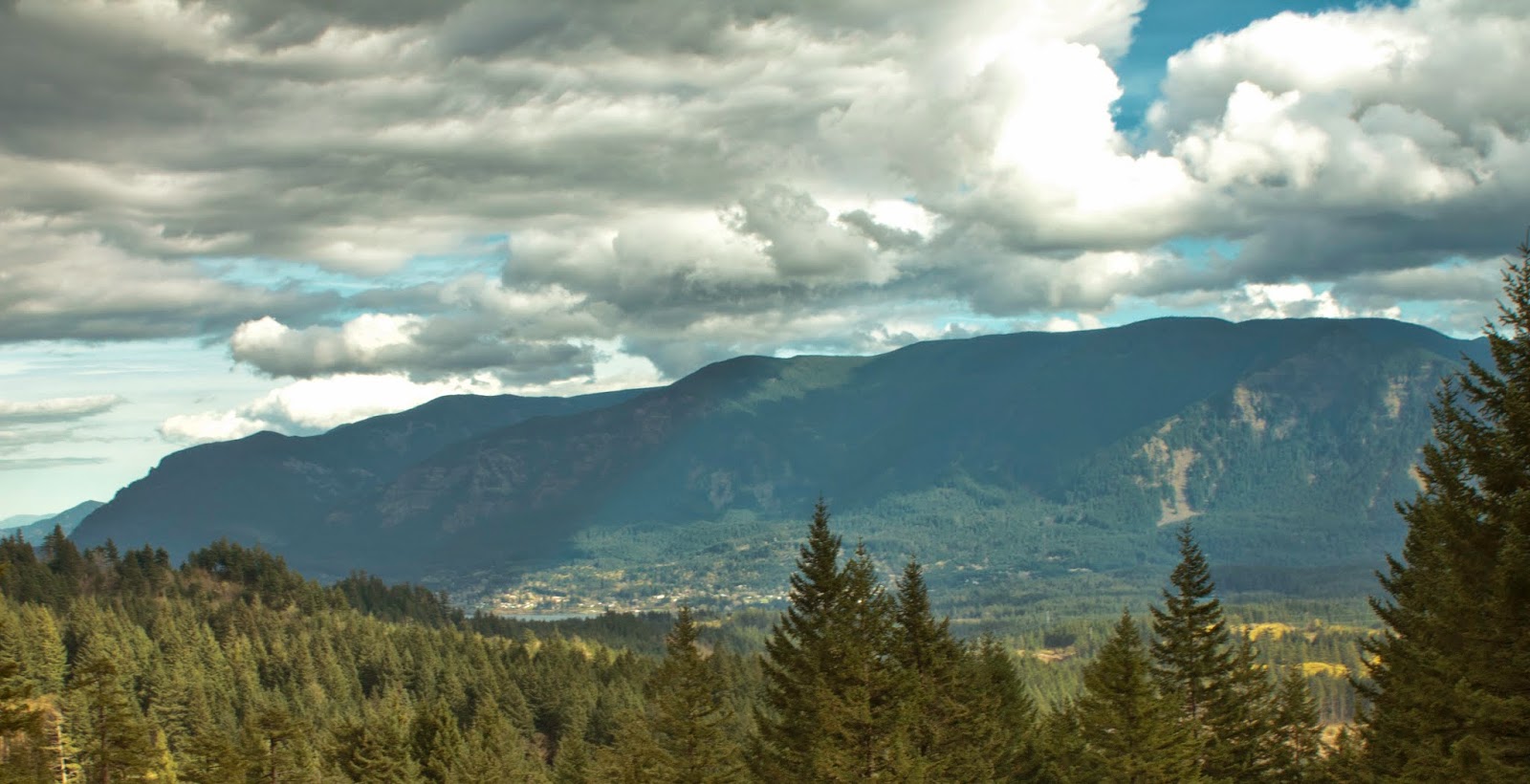
At about 3.5 miles the trees clear and everything opens up into stupendous views. Above you to the north is the giant cliff face of Table Mountain. To the left of the peak is the Heartbreak ridge cliff section, and the two big walls are the Two Chiefs the trail is named for. To the Southeast you get a great view of the Cascade locks area, Eagle Creek, The Benson Plateau, Herman Creek, Indian Point, Dog Mountain, and even to the hills east of Hood River. The ground here is almost all rocks covered in moss, as trees struggle to get a foothold in the landslide.

It was clear an old path goes up the landslide to the base of the cliffs for more exploring fun, but we were scrunched for time so we declined. The trail continues well past the landslide area towards Greenleaf peak, but we felt we'd gotten a good show so we turned back here. Back to the car gave us 8 miles exactly, with 1400 feet elevation gain. My feet hurt, but I felt good.

Messing around on the bridge over the creek that feeds Carpenter lake

Looking West in the slide area

South- View of Eagle Creek from Slide area

Looking up at Table Mountain from slide area

Looking East - Left most mtn. is Dog Mtn. Indian Point & Nick Eaton Ridge is rightmost cliff, Mitchell Point just beyond that on Oregon Side. Beyond that is the Catherine Creek area past Hood River, and waaaay in the distance is what I think is Stacker Butte across from the Dalles. 

The mightly cliff of Table, 2000 feet above us. I was up there!

Looking west

Closer view of the river pathway to the east

Dog Mtn meadows in easy view here (far left top)

The two chiefs

The Benson Plateau looms over Cascade Locks. Eagle creek drainage on the right.

Eagle Creek Drainage. Mt Hood is covered by clouds, but it's back there somewhere.

Shadows over the Herman Creek area

Indian Point is really obvious once you know what it looks like. I was up there!

Panorama looking up at Table from the slide area.

For an uncrowded hike the trail is in very good shape and not overgrown at all (which I wasn't expecting), this is clearly a well respected local secret. On a day where Multnomah Falls had at least 300 cars stifling the road with visitors, we saw 3 groups of people the entire trip and the parking lot had about 4 cars. The views aren't incredible but they are great in spots, and more so when you know the history of where you are standing. I'd file this in the same folder as Indian Point/Herman Creek Pinnacles - great for locals who've seen the main sights & want something with a little more solitude without sacrificing the adventure.

Hike Data - complete elevation charts and time

Monday, March 9, 2015

Eagle Creek Round 5, this time with a Tightrope Walker

The past two weekends we've gone to Eagle Creek to explore since we've had unreasonably nice weather for winter in Portland. Last weekend I took Keeley to Buck Point and the beginning of Ruckle Ridge, something I did last year by myself just for funsies, and to get a taste of the full hike we will be attempting later this year. This weekend we decided to return to the Eagle Creek trailhead, but this time do Eagle Creek proper with a friend who is new to the area and hadn't seen the gorge yet. 

First up, our previous weekend to Ruckle Ridge. The trail description is the same as the last time I was here and the day was hot. It was a struggle to reach the upper viewpoint on ruckle, which shows us just how out of shape we've fallen and how much we need to get back up to speed.

Table Mtn. Cliff from Buck Point. I was up there!

Hazy late February day on the Columbia

The entire Bonneville Dam complex

This weekend, since it was going to be nice again and our friend wanted to join up, we decided to head back to Eagle creek, since it's the "Classic gorge hike" that everyone in the area needs to experience once. We decided to make a full day out of it and hike the entire path to Tunnel & Twister Falls (6 miles in to where Eagle Creek splits, up to 7 miles if you have to park far away, which we did), which would make it only the second time I've gone that far. This is my 5th time hiking Eagle Creek and I've been treated to something new each time, although it was quite late on the hike before I got the new thing this go-round.

Hike was normal. Lots of haze and bad lighting for pictures. The water levels were alarmingly low, late summer levels of low, which goes to show just how dry our winter has been and how bad our summer is going to be. There has been no snowpack anywhere and Southern Oregon is already bracing for catastrophic wildfires. Last time I was here in March we couldn't reach Punchbowl due to sheer rain volume, yet this year it was like our August trip. Oregon is going to have a baaaaaaaaaaaad summer. But we might as well enjoy the nice winter before we all burn to death.

We made it out to Tunnel and Twister falls, made our way partly back before breaking for lunch, then began the foot achingly long rocky journey back to the car. Eagle Creek doesn't hurt your knees or legs because the grade is so mild, but the rocks will murder your feet by the time the hike is done.

Keeley walking past Tunnel Falls
Loowit Falls

Loowit Falls from near High Bridge

Keeley and Angela on 4-1/2 mile bridge


When we got back to Punchbowl we were greeted with a huge surprise. Some guy was tightrope walking over the creek. He was about halfway when we showed up, hikers gathered around. He had attached one rope to a tree by the upper overlook, and the other side was connected to some tree on the other side of the gorge past Punchbowl. I have literally no idea how anyone got to that side of the gorge, it's mostly cliff. But someone had, and the guy was walking the rope about 500 or so feet above the Punchbowl. 

He moved pretty fast and made it about 75% of the way before he lost his balance and had to sit on the rope for a bit (He was strapped in, he wouldn't have died anyway). It looked like they didn't pull the rope tight enough because he was dipping pretty far in the middle. Anyway that was unique and made the whole trip even more worth it.


He's the red dot

Over the Punchbowl chasm

middle of the rope

Strapped in, i'd say he's a wuss but I couldn't do it

from the back side

wide angle of the scene

We finally made it back to the car, had some delicious food at Ex Novo brewery and complained about how badly our feet hurt. Totally worth it.