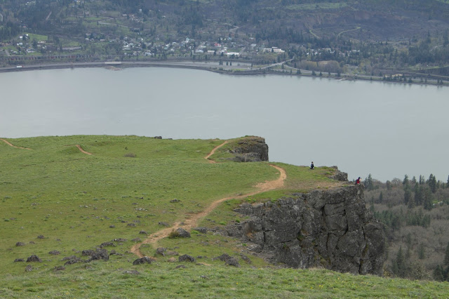
Jesus did a zombie thing once and now we call it Easter so we celebrated the day of bunnies laying eggs against the laws of nature by going on a hike to a cool new spot called Coyote Wall.
Coyote Wall is a massive cliff in the eastern gorge (past Hood River) on the Washington side. Some sort of geological thing happened here once. I don't really know what, I just know there is a big ass cliff there now, stretching from the river all the way up the hill.
There is a large labyrinth of trails here (One area is even called "The Labyrinth"). The area is a mountain biker's haven, so there are tons of cuts, loops, curves and weaves. It was clearly designed and made by mountain bikers before the hiking community really found it, because the trails are far more bike friendly than hiking friendly. On the plus side, that means no true backbreaker steepness since that would murder bikers. There are also old jeep roads and power lines. It's a very different area than most of the gorge, because it's in the dry desert area past the cascade line.
The trailhead is right below the base of the mega wall and it's pretty imposing and awe inspiring. A quick walk up the old, closed highway 8 takes you around the backside of the cliff and to the trail access. Since this was my first foray into the area and I don't have a map, I decided to keep it simple and hug the left, since that trail (The "little moab" trail), hugged the cliff. It's steeper, it's very rocky, but the views are great. Sadly, because it was a grey, colorless day, my pictures turned out kind of crap. I bet sunrise/sunset here on a clear day is spectacular.
 |
| The base of the wall from the trailhead parking lot |
 |
| Walking the wall to start |
 |
| Keeley looking west, Snowy Mt. Defiance far in the distance |
 |
| The parking lot from on the wall |
 |
| The Coyote Wall |
We climbed up through the desert dirt and shrubs. It's a fun climb. You basically just weave back and forth on the trail (or be boring and take the jeep road straight up), periodically hitting the edge of the wall for a view. The views get better with each step. Mt. Hood comes into view, Mt. Defiance comes into view, and Rowena Crest and the eastern gorge come into view. About 2/3rds of the way up, right past a large notch in the wall, you get the best overall view at about 270 degrees. Past that, up one final hill, the creepy tree line arrives and the views basically vanish. A small loop on a dangerous narrow trail goes into the woods, meets up at a dirt road, and loops back to the upper viewpoint. There used to be a trail that descended to the base of the wall for a true loop, but it was closed due to private land stuff.
 |
| Mosier Oregon from Coyote Wall |
 |
| Coyote Wall from the best viewpoint |
 |
| I called it "suicidal rock" |
 |
| That cliff 5 feet away from the biker is certain death, by the way |
From here we took the long way down, taking a more easterly path that weaved around Burns Farm slowly downhill. Lesser views, more peaceful, some wildflowers. Eventually we met back up at the wall and got back to the car. We admired our feat from below and then ate burgers and beer in Hood River.

An even 6.66 miles (on a day about Jesus lol) and around 1500 elevation gain.
Keeley's garmin data: https://www.strava.com/activities/945401638


No comments:
Post a Comment