After what felt like a month of agony, the rains came and the Eagle Creek Fire is out.
Some friends were in town and wanted to hike, so for both fun and for my own personal curiosity about the damage. We went back to do Cape Horn's full loop and I got to see some of the western gorge impact.
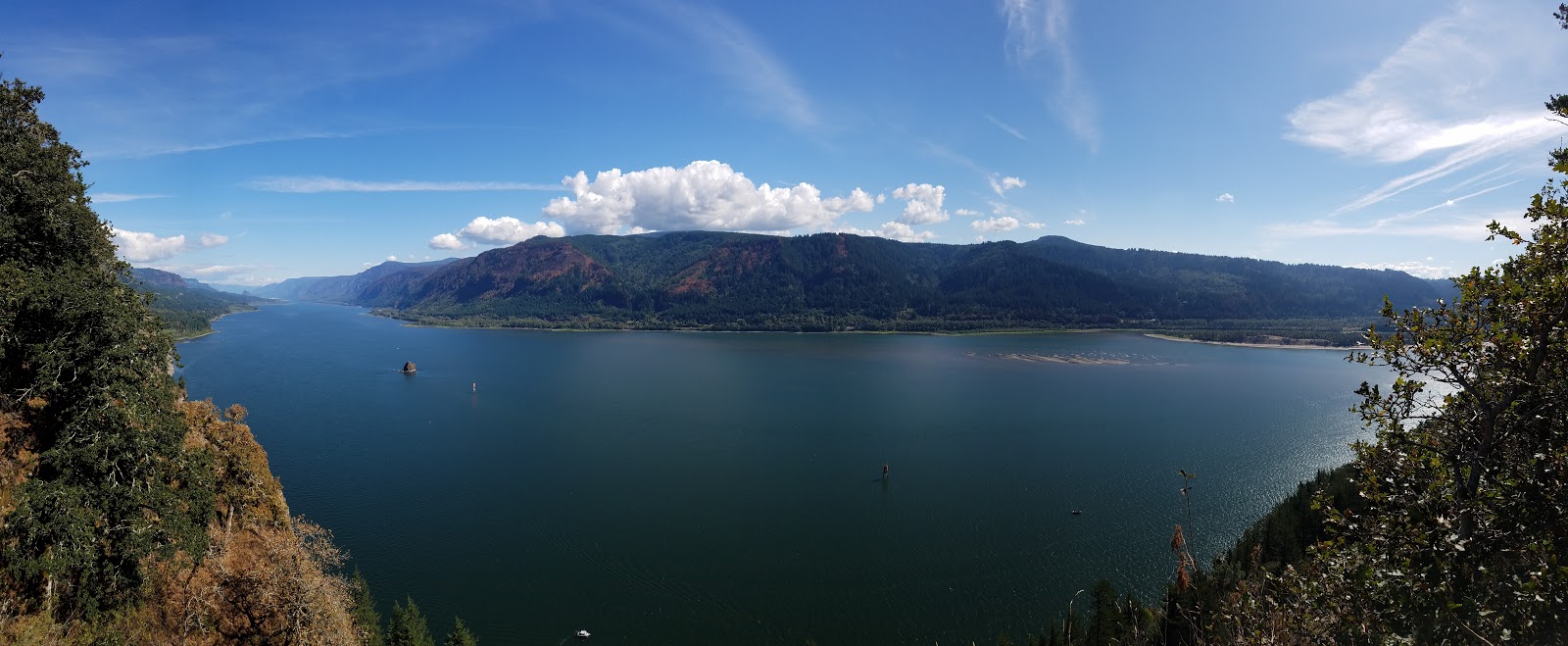
Cape Horn has gotten some work done since me and Keeley did the entire loop a few years ago. Several new viewpoints are official and actually built with a viewing platform and everything. The hike itself is still really good, with a lot of variety. You go uphill through jungle, past two awesome viewpoints, down past a farm to another great viewpoint, down the hill to the west to several more viewpoints, under the road, past a waterfall, down steep rocky switchbacks to a viewpoint near the river cliffs, then back up through a landslide to the base of the waterfall, and then finally up a beautiful farm country road for the final mile. A solid but not exhausting 7 miles.
 |
| The farmland under Cape Horn |
 |
| The damage to Angels Rest is very apparent |
 |
| Freshly burned Angels Rest |
My other purpose was to see what I could of the fire. Since my last post the fire spread to Herman Creek and got to Indian Point and the slopes of Mt. Defiance. At Cape Horn I could only see the far western burn but it was enough to tell some of the damage was pretty bad.
Angels rest got roasted. Devils rest got touched. the Oneonta area got really badly hit. Rock of Ages ridge is toast.
The
Oregonian did a gorge flyover, but didn't label the pictures. I'll repost these with labels, as my camera wasn't good enough to capture the gorge from the distance I was at.
Now for the labeled and very sobering images
 |
| Angels Rest re-burned everything from the 90's fire. The fire reached Devil's Rest's north side, likely along the ridge the Primrose path follows. We may get a view there now. The trail between Angels Rest and Wahkeena looks burnt. |
 |
| Tanner Ridge looks like it got some of the worst burning. Munra Ridge also appears to be toasted. Munra Point is an unofficial trail and the already loose slopes on the approach may landslide into nothing this winter. There should be more views along Tanner and Munra in the distant future though. |
 |
| The ridge of Multnomah Basin got hit bad, but the basin itself appears untouched. The fire didn't hit the flat areas. Franklin Ridge is toasted, but that might actually make the trail more interesting, should it survive (it likely will). The approach to Cougar Rock may now be impossible, and the Elevator Shaft may experience another slide if the burnt areas at the top give way. |
 |
| Nick Eaton ridge was hit but doesn't appear to be too badly. Indian Point looks to have experienced some burn, if it can or should be be reached remains a question. |
 |
| Yeon Mountain looks toasted. May end up offering views that didn't exist before. Same with Nesmith point, which didn't appear to get hit as badly. |
 |
| Rock of Ages Ridge got annihilated. I don't see how the unmaintained trail survives this level of instability. |
 |
| A view into the Oneonta area. Horsetail Ridge is toast. The Devils backbone on Rock of Ages is exposed and bare. |
It's heartbreaking. I expect most of the trails to stay closed through the winter and into spring as trained forest professionals figure out the true extent of the damage. We have no good views into the Eagle creek valley itself yet.
Triple Falls got roasted. Ruckel Ridge appears to have also been hit really bad. The Benson Plateau seems okay.
It's eventually going to be a great place again, but it's going to be some time before everything is truly over. Before the fire started, I was working on a hiking art piece about Eagle Creek, namely my favorite part: High Bridge. I decided to finish it, knowing it won't look anywhere close to this in the future. I'll put it up as my eulogy.


No comments:
Post a Comment