Out of every hike that has ever been on my to-do list, I think this one has been there the longest. This past Saturday I finally got out there and did it. It ended up being even better than I thought it would be. Top 10 hike for me. Easily the best views of Mt. Hood and the surrounding area I've ever gotten.
THE GOAL
The McNeil Point shelter on McNeil Point. On the northwest side of Hood, along Bald Mtn ridge, there is a high jut just at the edge of the treeline on the mountain that has a stone shelter built on it. This is McNeil Point.
THE PLAN
Get to Top Spur trailhead reasonably early, climb the trail, be happy.
THE TRIP
We left the house at 8:20 and arrived a bit after 9:30. We also had my friend Scott join us for the hike. The trailhead was already obscenely crowded. The trailhead itself is maybe 10-15 cars wide, but past that people just parked along the side of the narrow gravel road for at least a quarter mile in both directions. I'm glad I didn't have to pass anyone finding a spot, there is not enough room next to the side of the road. I knew this trail was busy and it was a perfect weather day but this was still pretty rough.
The trail immediately leaves the road and starts uphill to gain the ridge. After a half mile or so of climbing, it finally reaches the PCT and you turn right. Almost 30 yards ahead is confusion junction. We obviously had to take the Bald Mtn. detour to start, and we got ourselves a glorious view within the first mile.
 |
| Mt Hood down Yocum Ridge from Bald Mtn |
After getting some pics and popping back onto the trail, the real work began. Shortly past re-joining the Timberline trail we stayed right at the McGee Creek junction and started climbing the ridge in earnest.
The trail passes through some brushy areas and then follows the top of the forested ridge for the first mile. Thankfully the trail is really nice and doesn't climb too harshly. The light speckles through the trees once you gain the top of the ridge proper and occasionally tantalizes you with peeks of the mountain. After maybe a bit over a mile from Bald Mountain, the trail opens into a hanging meadow filled with flowers and a spectacular view of Mount Hood and across the Muddy Fork valley to Yocum Ridge.
 |
| the surprisingly huge and remote Yocum Ridge Falls |
Maybe a half mile past that meadow, the ridge begins to lose a bit of elevation but opens into yet another meadow with more spectacular views.
 |
| The big cliff/ridge on frame left is McNeil Point, our destination |
The trail then begins to veer northeast away from the ridge. A sharp eye might spot the scramble shortcut trail to McNeil Point from here, but I wasn't going to try it on my first visit with the dog in tow. The trail switchbacks a few times and climbs harder than it has been here and then takes a definite turn to the north. At this point the trail crosses over some small mountain streams, including one that is covered in beautiful mossy rocks. Then it briefly descends downhill again and passes through a small meadow with a view under McNeil Point. After another quick uphill, the trail arrives in a larger meadow next to several ponds full of frogs and a wonderful view back towards the mountain looming over the McNeil Point ridge.
 |
| McNeil Point looms, Mt Hood in the distance |
|
|
|
|
 |
| The pond meadows |
 |
| I would recommend the slight detour to the end of the pond meadows for this view |
From the end of the first pond the trail appears to split with only a sign that says "No camping in meadows". The right trail goes uphill into the trees and the left path follows along more ponds and it quickly became clear that this was not the correct way to go. We turned back and took the right path and started switch-backing up to another ridge.
 |
| Eye lighting on the pup |
Once we gained the ridge, the trees began to thin out. The views begin to open up more and we got our first glimpse of the other volcanoes in the distance. The trail passes over a view what I believe to be a southern fork of Ladd Creek and then climbs through a wide gully and regains the ridge. It is about a mile to the shelter from here, and this is when everything becomes truly worth it.
The views open up to all sides and every step increases the visual splendor. You get most views to the northwest and we could spot Lost Lake among the many ridges and mountains.
 |
| Bald mtn |
 |
| Looking back while on the way up |
 |
| Looking back on the muddy fork valley |
 |
| The final mile is all views |
 |
| Luna surveys her domain |
The trail curves around over a snowbank, traverses a small jutting ridge, then begins the final climb up the alpine slopes to the shelter point. The trail is a bit sketchy here due to the lack of roots keeping it in place but navigation is easy. The shelter is low on the McNeil Point ridge and made a perfect break spot. It faces due west, and if the haze had been a bit clearer, we might have been able to see Portland. we could see the Willamette Valley expanse plus the faint hint of the coast range.
 |
| Proud summit pic |
 |
| Bald mountain ridge, with the meadow in view. Our path up. |
 |
| Lost lake |
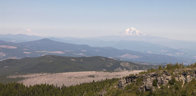 |
| The dollar lake burn with two volcanoes in the distance |
 |
| The ponds where we got lost |
After chatting with some other hikers, including a guy we'd interacted with a few times on the way up, we set back off and began the long journey back to the car along the same route. We got back to an even worse parking situation, tired and happy.
 |
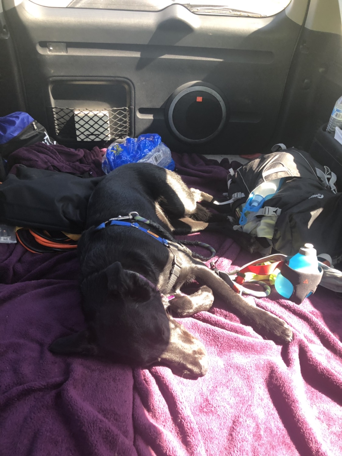
| Tuckered out pup |
THE RESULTS
10 miles, 2500 feet of elevation gain.
This hike is listed in almost every hiking guidebook/site as a fairly important must-see for folks capable of doing it, and I can safely agree. The final mile was incredible and there was no shortage of amazing views leading to that point. Bald Mountain ensures that even the weakest of hikers can get something good for 2 miles of effort, and the views just improve from there. The road to the trailhead is long and occasionally a bit rough, but a passenger car can handle it. The climb is certainly an effort but the trail never gets
too steep and it offers plenty of flatter sections to regain your strength.
 |
| Our hike |


No comments:
Post a Comment