Pages

Monday, November 13, 2017

The Clackamas River Trail


One good thing about the gorge turning into well done toast is that it's forced me to go else-ware for stuff and we are finding some neat things that we may not have gotten to otherwise.

Case in point: The Clackamas River Trail. It's pretty okay!

THE GOAL
Reach Pup Creek Falls, which is halfway through the CRT

THE PLAN
We would do the first half to Pup Creek and then head back the same way. No loop options here.

THE TRIP

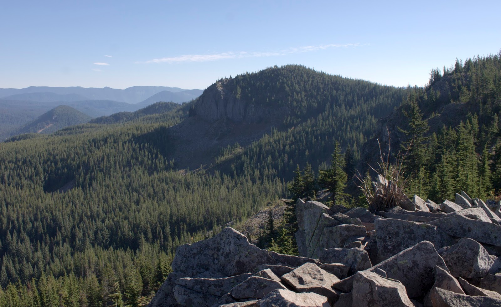
The Clackamas River Trail is simply put, a trail that follows a section of the Clackamas River. I tried picking something that would be a good winter month hike, for when things are overcast and a little bit wet. The Clack seemed flat enough and simple enough. Just walk along the river to a waterfall, and head back the same way. There are 4 more miles of the CRT past Pup Creek Falls, but there is no loop option. It's just a long walk on the river.

Turns out the CRT is on the West Cascades Scenic Byway, and it earned that name for sure. As soon as you get through po-dunk Estacada highway 224 crests a mountain and the scenery kicks into high gear. The Clack cut a big canyon and the sheer rock walls on both sides of the massive mountain river are very easy on the eyes. There is also a lot of patchwork death, as a fire clearly hit this area some point in recent history. The pockets of dead grey trees lining the hills made me wonder if this is how the gorge will look for the next decade or more.

The views are great and there are tons of places to pull off and admire the scenery. We didn't take any, because we were running a bit late and with the sun going down at 4pm is we didn't want to get stranded in the dark. I didn't take many pictures overall.

The trail is pretty reasonable. The first half-mile or so is quite flat and nice. You don't get a view immediately, but once you do, it mostly stays there with you. The trail is surprisingly precarious past the first mile. After the first flat mile, the trail climbs a reasonably tall hill (The worst hill of the hike) and then the next 3 miles are basically just up and down. You'll be near water-level, then you'll be 100-200 feet above it, and then back down. The trail isn't very wide and a couple sections actually would probably kill you if you fell, which made this "family friendly" hike seem weirdly dangerous. Overall though it's a very enjoyable walk through the woods with occasional river views. The Clack is very big and wide and fast rolling.

The first "beach" on the Clack

The mighty Clack

Clackamas River

After enough up and down, you settle into a flat power line section and a small signed side trail says "Pup Creek Falls .2". A quick side trip takes you to a spectacular waterfall that feels like a smaller version of Multnomah Falls. A tall steep drop, then fans down the rocks, then drops a second story. It's a great waterfall and a great turnaround point. We saw it during the wet season, which likely made it that much more impressive.

The easy trail to Pup Creek


I call this "Annoyed Husband waits for wife to be ready for picture"


Then it was a turn around and a nice slightly wet walk back. The rain started right as we reached the car.

THE RESULTS

8 Miles, roughly 1000ft of elevation gain. The elevation is only tiring on that first hill, and is relatively unnoticeable over the rest as it never climbs for long before going back down. It's an easy hike and great for winter, though it's no show-stopper must do. At some point later this year we may drive to the far trailhead and hike the second half.

Tuesday, October 31, 2017

Dave & Keeley Hike Tom Dick & Harry


Keeley was officially brought on full time at her job, which was cause for celebration! We celebrated the only way we know how: by walking around the woods before drinking beer and eating burgers at a brewery. Any excuse to mark off something new on the list! 

THE GOAL
Mirror Lake is a beautiful smallish lake on the southern flank of Mount Hood. Resting above it is Tom Dick & Harry Mountain, named as such because it is a long ridge that has three summits. The trail goes to both. 

THE PLAN
Get To Mirror Lake trailhead early, do the hike, go to Hood River and celebrate the new job with some beer and burgers at Pfriem.

THE TRIP
Portland was cold, rainy, and cloudy with little visibility, which was a bad sign. Thankfully, once we got into the cascade foothills the clouds just abruptly stopped and the sky was clear. The trailhead is basically just a pullout off of HW 26. The trailhead was already full when we got there at 930. There were approximately 10 billion signs indicated no parking with threat of towing, which left us feeling kind of lost. Luckily, another friendly hiker told us about the Ski Bowl parking lot a mile up the road, which we drove to. It would add 2 miles to our hike, and both those miles were walking behind the guardrail on HW 26, but the peace of mind that we wouldn't get towed was worth it.

The trail to Mirror lake is about a mile long and is mostly just wide well graded switchbacks slowly up the side of the hill. It's a great walk through the woods and never very strenuous. After a while, you suddenly come across the Mirror Lake outflow creek and the first junction. The left trail winds around Mirror Lake. The right trail goes along the shore for a brief stretch then climbs up to TDH Mtn. We took the right trail, we could chill at beautiful Mirror Lake later.


We still stopped for some photos though, especially since our goal sat up behind the lake looking ominous.


Mirror Lake


The trail to TDH continues the gentle climb for another mile on a big long backside route. There is an open air talus slope halfway up that offers a fantastic view of mountain and the valley HW 26 climbs up.


After another mile of moderate climbing, the trail hits a gigantic man-made 8 foot tall pile of rocks and takes a hard left. The rest of the trail is mostly flat ridge walking until you hit another massive pile of rocks, but this time the pile of rocks is the summit.

Tree had a dick


Giant rock pile

The summit of TDH is incredible. It offers the best view of Mt. Hood I've ever gotten on a hike. The mountain just looms in front of you. Mirror Lake is visible down below. Off to the east you can see the town of Government Camp nestled in the trees. If you look really hard, you can find the Timberline Lodge. The other 4 volcanoes are visible as well. Adams sits on Hood's left flank. Rainer behind it. St. Helens off to the northwest. Behind you, a fantastic view to Oallie Butte and Mt. Jefferson. Truly worth it.

A full 360 panorama from the top


Mt Jefferson


The third summit of TDH

Mt Adams


The Timberline Lodge (Top right of the bare line leading down on the right side)

Government Camp

Mirror Lake

People on the lakeside


Dick and Harry summits

We hung out on the summit taking photos for a while then headed back down the trail to Mirror Lake, this time taking the loop trail to the backside of the lake. The lake wasn't a perfect mirror, but it was a pretty decent one.


Love that dick shadow


After that we walked back to the car, happy. Mirror Lake is totally worth the visit. You can camp here too, but with a lack of other trails off of the path, it might work better as a day visit.

Our burger at Pfriem was amazing and the traffic jam we hit on the way back was garbage. The Gorge did a bit of landsliding last week apparently.


RESULTS:
8 miles, 1600 ft of elevation gain, A good hike.
https://www.strava.com/activities/1253014147