Is it pronounced Yoh-cum or Yak-um? Someone tell me.
First camp of the year! We had an extended plan this holiday weekend to finally get back out in the tent and camp again. After a few weeks of setbacks, we made it happen.
THE GOAL
Backpack to Ramona Falls, hike to Yocum Ridge the next day, then back after we returned to camp.
THE PLAN
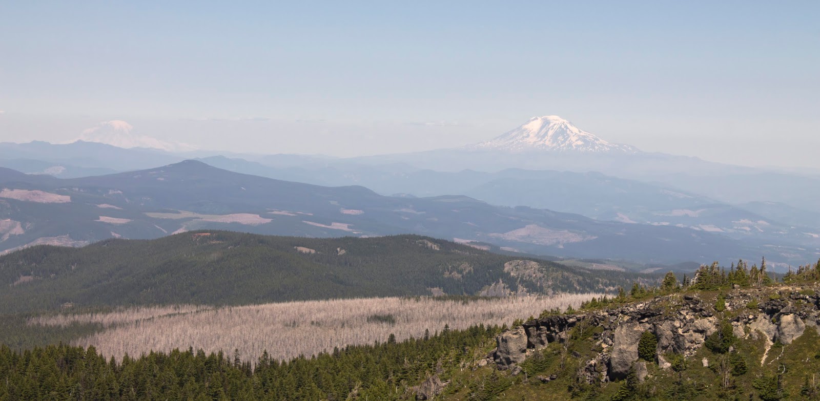
Yocum Ridge is a remote ridge connected to Mount Hood's west flank. It is essentially the mountain itself on the higher reaches. As a day hike, it is close to 17 total miles and 3600 feet of elevation gain. Almost unobtainable for all but the heartiest of hikers. I've only accomplished a day that extreme once. However, as Yocum is connected to Ramona Falls, and Ramona Falls has campsites...there is a way to make it easier. If we could backpack out to Ramona the night before, we could do Yocum early morning as a day hike. It would shave off close to 1000 feet of elevation and at least 6 miles to the individual trip. We'd still have a tough day on our hands, especially since we'd then have to backpack out after we got back, but it would be feasible.
So...drive out Friday evening, backpack to the falls, find a campsite, camp the night, get up early, hike the ridge, come back and rest at camp, backpack out.
THE TRIP
We left around 3:30 for the trailhead. I was worried the place would be busy with 4th of July campers and we wouldn't find a spot. My worry was partially accurate, as the area was packed but it ended up being mostly day hikers and car campers. Ramona Falls had lots of open sites.
The backpack to Ramona was uneventful and easy. No hassle whatsoever and 3 miles/1000 feet gain isn't hard even with big packs on. We came to the falls, took a few pics, then wandered to find a spot. There are a lot of well-hidden camping spots near the falls uphill to the right. A couple were taken. A side trail by the horse corral led to a small site, then another small site, then uphill another 30 yards we found a completely secluded open area with a dozen sites. This was a big party meadow but we had it all to ourselves.
After exploring around a bit and eating some dinner, we settled in around 8:30. The light wouldn't go out for another hour, but it felt good to rest. None of us (dog included) got great sleep, but we could see the stars.
at 5:30 it was light again and the dog decided it was awake time now. We got up, made breakfast, got what we needed from our packs (just water, snacks, and my camera) and set of for Yocum.
The Timberline trail cuts off uphill onto Yocum Ridge immediately after the bridge over Ramona Creek by the falls and the first mile was undoubtedly the hardest. It climbs northwest up the flank of the ridge through dense rhododendrons, and over a bridge in pretty rough shape. After a little less than a mile, the trail reaches the apex of the ridge and this is where the junction with the Yocum trail is.
The first two miles of the Yocum Ridge trail aren't very interesting. It's a steady but reasonable climb through the woods, going up the south flank. It eventually passes a boulder field with a slight view, then switchbacks, climbs to the north side of the ridge, meanders back to the south flank, switchbacks again after another boulder field with a slight view, and then finally you pass by a small swampy pond and the trail gets fun.
 |
| Beargrass closeup |

The pond is gross stagnant glacier snowmelt water. Mosquitoes are almost certainly bad here. We still saw some people camped, without a tent, on the east side.
After the pond the trees open up a bit and the trail gets a bit flatter. We started seeing pockets of snow and a ton of avalanche lilies, as well as some beargrass. There are open sections of canopy where snow clearly gathers. The trail passed over a creek a few times and rose further up.
 |
| So many Avalanche Lilies |
 |
| So many lilies |
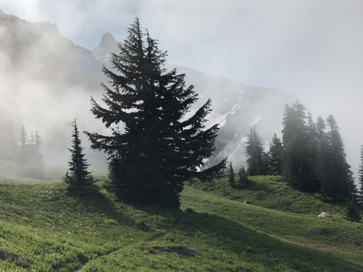
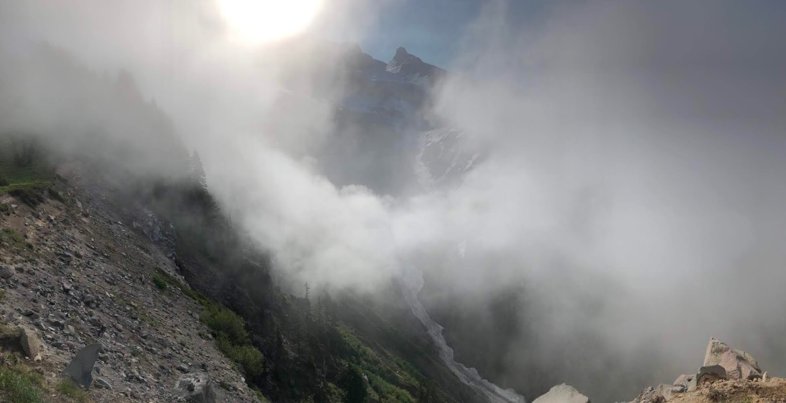
After 2 miles of that, the space began to really open. This is where we kind of got screwed in terms of weather. It was to be a cloudy day, and we couldn't see the obvious vast expanse beyond. We had a great misty atmosphere setting an incredible isolated scene but we definitely got shortchanged on distance views. It could have been worse though, we still got tantalizing hints through the mist.
Then we turned a corner and saw the mountain through the mist. We only would catch glimpses of it for the next hour when the clouds shifted favorably, but it was still something special. The trail ends at a grand overlook of the Sandy River valley, looking up at the mountain. With the mist obscuring the views in dramatic ways, it was truly special. Even though we didn't get the full picture it was still beyond outstanding. One of the more magical things I've experienced on a hike. The pictures will never do it justice.
The trail actually continues here, though in a rougher shape. It turns back and keeps going up. It apparently climbs to more views, but after our break the clouds were getting worse and we didn't think it was worth the effort to climb that far for no views. When we turned around, we saw a weird bird just strolling along. I wasn't able to get close enough for a better picture, but it was extremely random and neat. Internet research indicates it may have been a male
Dusky Grouse. The neck plumage gave it away. Drove the dog nuts.
We sadly accepted our lack of views and headed back. It was 9am. We had been hiking since 6:30. We were 6 miles in. Time to go downhill.
 |
| A panorama of the valley viewpoint with the mist almost becomes a surrealist art piece |
The trip down was obviously faster and we got back to camp, sore and tired, at 11am. 11 miles in. The tourist crowds had already descended upon Ramona and it was a shock after the remote solitude of Yocum Ridge. I've never hated tourist hikers more. Ramona has been lost to the masses. You can't even get a good picture without someone in the way or being obnoxious.
We rested at camp for a while, changed socks, and packed up. at 12pm, we set off with our packs for the final 3 miles of the day, all downhill. We were back at the car a little after 1.
All in all, a wonderful day in the woods.
THE RESULTS
Saturday was 14 miles and 2600 feet of elevation gain (3600 loss). My legs are beat. Yocum's difficulty definitely comes from distance. The climb itself is steady but not nearly as bad as a lot of tough gorge hikes. I wouldn't mind coming back one day when things are clear to see what I missed out on picture-wise. Overall though I have no regrets. Yocum was worth the effort and it would be worth the effort a second time.
I write this in bed Saturday night, legs feeling like bricks, with a deeply sleepy dog next to me.