

I got sick right before flying home for Christmas and the flights/jet lag just compounded the illness, leaving me fatigued and stuck with the world's most annoying throat tickle for weeks. I had to spend 3 weeks sucking down lozenges and tea at a rate no human should just to keep my throat happy so I wouldn't cough.
Then, upon landing back in Portland on New Years Eve, our taxi got into a crash coming home from the airport and I was thrown into the seat belt pretty hard. My sternum and ribs were bruised, just a few months after falling off my bike and suffering a similar fate. So now I was in pain and sick. If I coughed my entire body screamed.
I got prescribed some pain meds and eventually started getting over the cold. The pain meds were strong anti-inflammatories that then ate my stomach wall and gave me horrible acid. So I was then stuck on prilosec for two weeks, which makes me feel bloated and gross.
I finally seemed to get through this nightmare by later Feb and felt good enough to go for the first hike of the year. When we got out to the gorge for the Gillette lake hike, the parking area was still covered in snow, and when I decided to bail and go back to Beacon Rock, we got stuck in the slush.
I had to dig enough of the snow out to give us some traction, and in the process hurt my back. So for another two weeks I was completely out of commission, walking around with a heating pad tucked in my pants and lying down as often as possible.
In the past couple weeks it finally felt like I was out of the woods and things had improved to the point where I could go outside again. So I did. We came back out to Gillette Lake to retry the season and this time, it was good.
Last time we came here, it was rainy and cold. This time we fared a bit better. It wasn't quite sunny, but it was warm and clear.
THE GOAL
Gillette Lake
THE PLAN
Just head out to the lake and turn around. Get a few pictures of stuff we couldn't see last time, maybe explore a bit further towards the Greenleaf overlook. Scout for potential future exploration.
THE TRIP
It amazes me how gentle and easy this hike actually is. It offers a very accessible hike to a neat spot for comparatively little work. The toughest climb is right at the start, and from that point on you just slowly undulate through weaves and bumps in the Table Mtn. landslide remains.
The first two miles switch between forest walking and meandering through the remains of an old clearcut with mild views into the distance. The trail is never straight and you'll turn a lot, but it only goes uphill at a gentle rate and offers plenty of variety. The landscape is strange and bumpy, with few defined ridges, just a lot of small ridges and bumps of rock that slid down a long time ago. Old overgrown logging roads constantly intersect the trail and definitely seem to offer a bit of interest to me for a future trip and future off-trail exploring.


Once you reach a more substantial clearcut and see the trail wander up the hill in front of you the good stuff kicks in. You reach the top of the ridge, intersect with a currently in-use logging road, and get a pretty solid view towards Table Mtn and the Oregon side over Bonneville Dam.
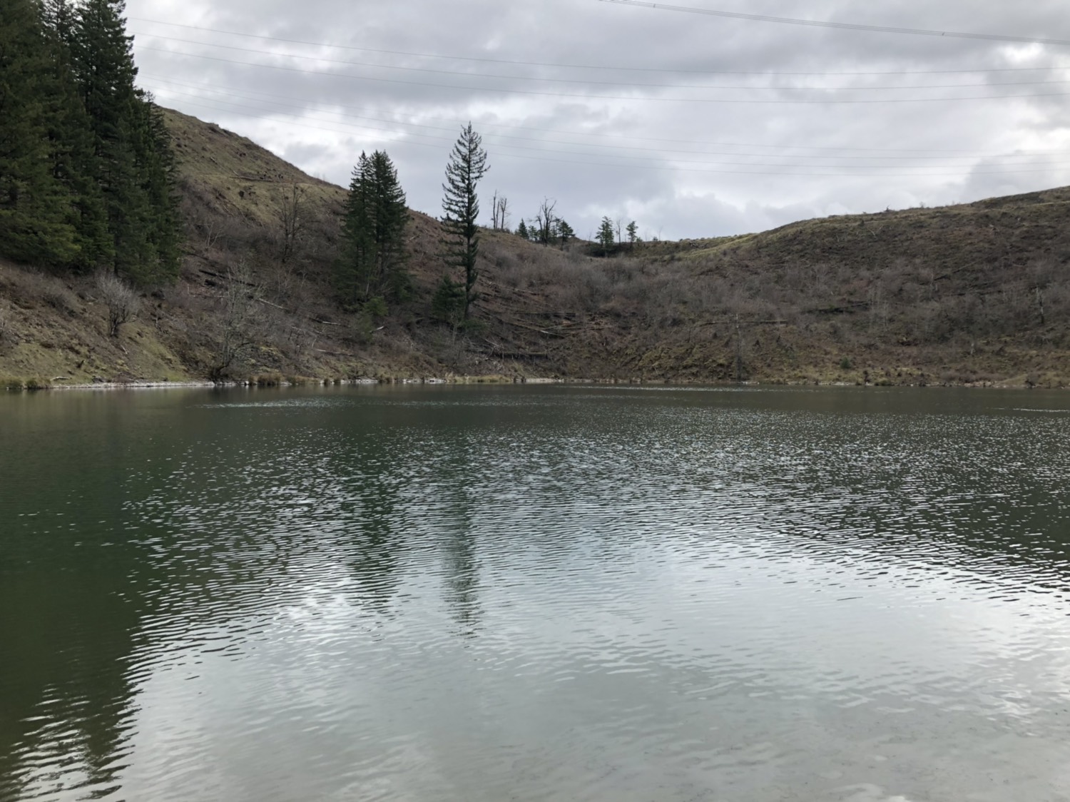
Gillette Lake lies down below you and a quick stroll puts you at the camping spots near the feeder stream. It is a nice spot to chill. The lake is a weird green color. A little log bridge crosses the feeder stream to the north and soon you climb back out of the bowl into the remains of another clearcut. From here the trail heads towards the trees and offers you some views across the river. We saw a snake. It also intersects Blue Lake road, a logging road that I definitely want to come back to. This whole area is littered with roads to explore on off days.
 |
| Gillette Lake and Table Mountain |
 |
| Old roads |
 |
| the trail down to Gillette Lake |
 |
| Gillette Lake |


 |
| Apparently I have no torso |
 |
| Lake |
 |
| The Luna Lean |
We eventually turned around at the bridge over Greenleaf Creek, just past the second lake. We didn't want to go all the way to the overlook. On the way back we explored off-trail a tiny bit near Gillette Lake, but didn't do too much. We passed a ton of people on the way back. Maybe the closure of half the Oregon side and spring break had people out here in droves.
 |
| SNAKE |
 |
| Happy hikers |
 |
| Greenleaf Creek |
 |
| Greenleaf Creek |
 |
| Sometimes it's hard to capture the scale of the gorge in a photo, but seeing the Bonneville Hot Springs building and the dam really helps show how big these cliffs actually are |
 |
| Happy Hiker |
THE RESULTS
Roughly 7.6 miles and 1000 feet of total elevation gain. It is an extremely easy 1000 feet, since it comes in very short or very gentle climbs over a long path. This trail will never blow your mind, but for the folks like me who just want to get outside and have to wait for the snow to melt, it provides a lot of easy fun, and I will come back at some point to explore the old roads some more.