

Keeley was officially brought on full time at her job, which was cause for celebration! We celebrated the only way we know how: by walking around the woods before drinking beer and eating burgers at a brewery. Any excuse to mark off something new on the list!
THE GOAL
Mirror Lake is a beautiful smallish lake on the southern flank of Mount Hood. Resting above it is Tom Dick & Harry Mountain, named as such because it is a long ridge that has three summits. The trail goes to both.
THE PLAN
Get To Mirror Lake trailhead early, do the hike, go to Hood River and celebrate the new job with some beer and burgers at Pfriem.THE TRIP
Portland was cold, rainy, and cloudy with little visibility, which was a bad sign. Thankfully, once we got into the cascade foothills the clouds just abruptly stopped and the sky was clear. The trailhead is basically just a pullout off of HW 26. The trailhead was already full when we got there at 930. There were approximately 10 billion signs indicated no parking with threat of towing, which left us feeling kind of lost. Luckily, another friendly hiker told us about the Ski Bowl parking lot a mile up the road, which we drove to. It would add 2 miles to our hike, and both those miles were walking behind the guardrail on HW 26, but the peace of mind that we wouldn't get towed was worth it.
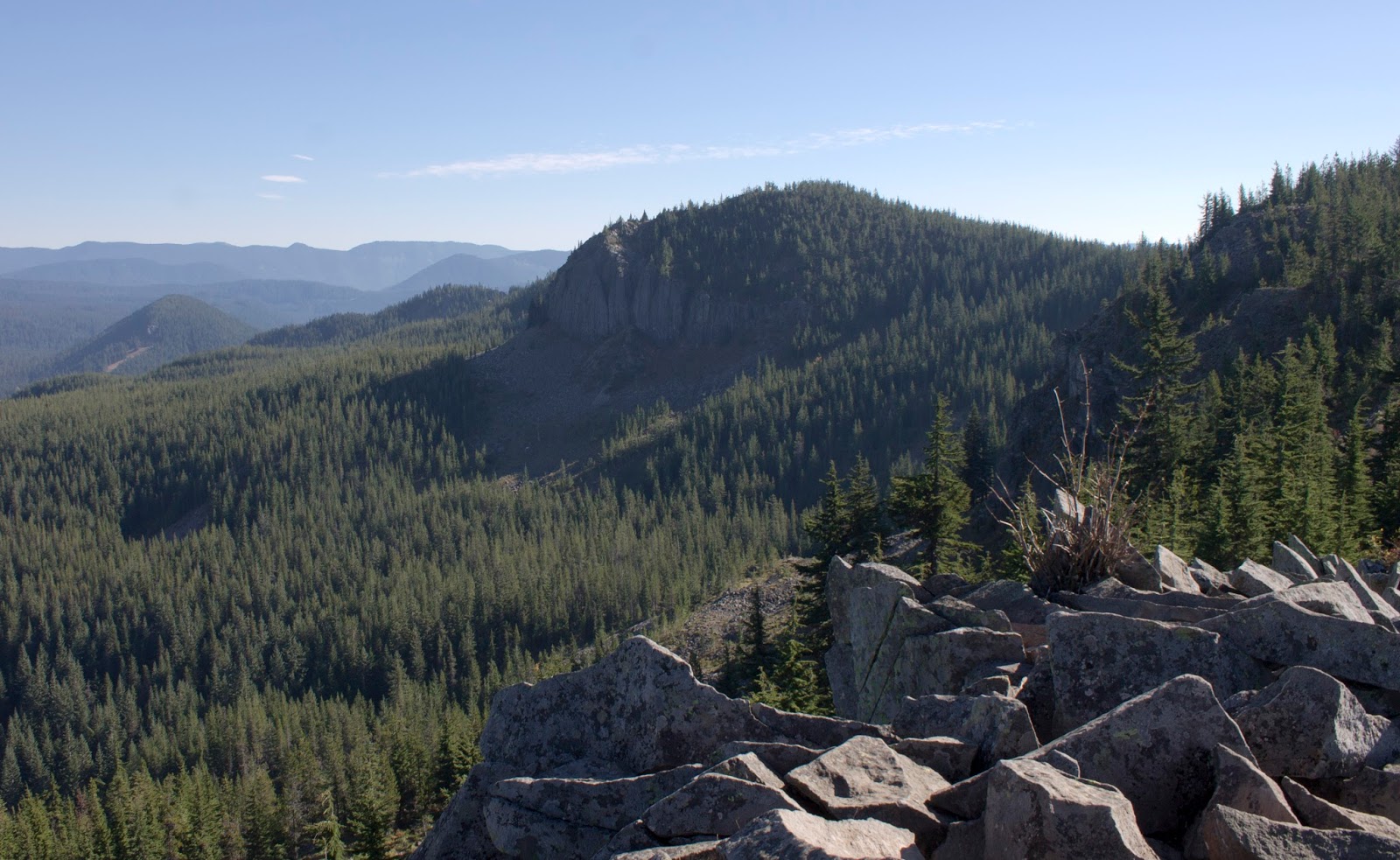
The trail to Mirror lake is about a mile long and is mostly just wide well graded switchbacks slowly up the side of the hill. It's a great walk through the woods and never very strenuous. After a while, you suddenly come across the Mirror Lake outflow creek and the first junction. The left trail winds around Mirror Lake. The right trail goes along the shore for a brief stretch then climbs up to TDH Mtn. We took the right trail, we could chill at beautiful Mirror Lake later.

We still stopped for some photos though, especially since our goal sat up behind the lake looking ominous.
 |
| Mirror Lake |

The trail to TDH continues the gentle climb for another mile on a big long backside route. There is an open air talus slope halfway up that offers a fantastic view of mountain and the valley HW 26 climbs up.


After another mile of moderate climbing, the trail hits a gigantic man-made 8 foot tall pile of rocks and takes a hard left. The rest of the trail is mostly flat ridge walking until you hit another massive pile of rocks, but this time the pile of rocks is the summit.
 |
| Tree had a dick |

 |
| Giant rock pile |
The summit of TDH is incredible. It offers the best view of Mt. Hood I've ever gotten on a hike. The mountain just looms in front of you. Mirror Lake is visible down below. Off to the east you can see the town of Government Camp nestled in the trees. If you look really hard, you can find the Timberline Lodge. The other 4 volcanoes are visible as well. Adams sits on Hood's left flank. Rainer behind it. St. Helens off to the northwest. Behind you, a fantastic view to Oallie Butte and Mt. Jefferson. Truly worth it.
 |
| A full 360 panorama from the top |


 |
| Mt Jefferson |


 |
| The third summit of TDH |
 |
| Mt Adams |

 |
| The Timberline Lodge (Top right of the bare line leading down on the right side) |
 |
| Government Camp |
 |
| Mirror Lake |
 |
| People on the lakeside |


 |
| Dick and Harry summits |
We hung out on the summit taking photos for a while then headed back down the trail to Mirror Lake, this time taking the loop trail to the backside of the lake. The lake wasn't a perfect mirror, but it was a pretty decent one.

 |
| Love that dick shadow |


After that we walked back to the car, happy. Mirror Lake is totally worth the visit. You can camp here too, but with a lack of other trails off of the path, it might work better as a day visit.
Our burger at Pfriem was amazing and the traffic jam we hit on the way back was garbage. The Gorge did a bit of landsliding last week apparently.

RESULTS:
8 miles, 1600 ft of elevation gain, A good hike.
https://www.strava.com/activities/1253014147


