Pages

Wednesday, January 20, 2016

Gillette Lake and the first hike of the year

It's been a while since I updated, and it's not like I haven't gone out, but things have been slower. December was the rainiest month in Portland history and thanks to some landslides and storms we kept mostly indoors. Our last hike of the year was Mid-December, a quick and easy Multnomah Falls - Wakeena Falls loop of five miles in the rain. I didn't even take my camera. It was nice to see the falls and the creeks roaring again after two dry winters.

Then once we got back to PDX after an extended holiday break, it snowed and the city shut down. So we finally got around to going on another hike this past weekend. I was eager to see what damage the storms had caused, and to explore something new. It was expected to rain and neither of us are in good shape, so we chose a long but very low level hike near Table Mountain that we hadn't done yet.

It's a simple hike along the PCT that weaves through the old landslide of Table until it eventually starts climbing the mountain later on. The hike starts at the Bonnevile Trailhead next to the Washington side of the dam. This used to be the starting spot of Table Mountain hikes. From here Table Mountain's summit is 7.5 miles away, making a 15 miles + hike. This was a hike best reserved for dedicated people. Then someone discovered a way to chop that hike down to 8 miles by parking at the Aldrich Fire Road so now that hike is solely for masochists.

These days there is pretty much no reason to start at this trailhead unless you want something easy and flat. The trail starts at the TH, quickly meets up with the PCT coming from across the Bridge of the Gods, then goes through several clearcut forests and powerline roads till you see a pretty lake and a modest overlook before meeting up with the Two Chiefs trail. I'll be honest, I did this hike purely for the OCD hiker who wanted to mark it off on his map. My map of what I've hiked in the Table Mountain area is now very complex.

It's 4.5 miles to the Two Chiefs junction, so 9 miles in total. It's long, but you only gain 700 feet of elevation the entire trip, so the only tough part is the distance. And if you do it in the rain, which we did, because we are stupid. The landscapes were actually amazing but I didn't take a lot of pictures due to the rain. People don't usually hike in this weather for obvious reasons, but there is a certain charm to how everything looks in the gray mist. It's very fantastical and eerie.

The trail starts at the parking lot, goes up a hill and then wanders through the woods. The recent storms have ravaged this area, trees and branches were down everywhere. You meet up with the PCT after a half mile, then enter the first clearcut. This is an old clearcut. There are some views to the Benson Plateau to the south behind you and to Table to the northwest. Soon you are back in the woods on the side of a short ridge. This area was a nightmare of damage. Trees down everywhere. It's going to take months to clear this out, even with chainsaws.

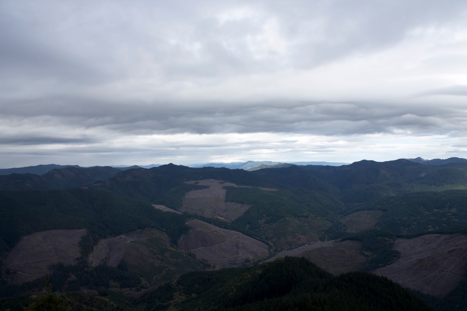
Past the downfalls is the second clearcut. The trail opens up into a rocky hillside and climbs a little bit through the mess, under some powerlines, then descends to surprisingly pretty Gillette Lake. The lake has a greenish hue that makes it look tropical. It's a nice spot with lots of campsites. Cross a stream, go through more clearcut, cross another, bigger stream, and head up into the forest. Soon you'll hit the Greenleaf overlook, which is really just a clear spot in the trees to the south. Half a mile more and you hit the junction and we turned around.

The rain started hitting hard on the way back and the trip was wet, cold and miserable. Because the rain kept up we never actually stopped moving and took a break, so we walked 9 miles straight, which wiped us out despite the lack of elevation.
 

Greenleaf overlook. The Benson Plateau in the distance
The Benson to the south over the clearcuts

Gillette Lake
The gorge in the mist


Sunday, November 8, 2015

Table Rock

Last year Keeley saw a post made by the US Department of the Interior on Instagram (The best Instagram account out there, frankly) featuring a beautiful mysterious image of a place called "Table Rock Wildnerness, Oregon". I'd never heard of it. She wanted to see it. I figured okay. We never made it out there last year, and with this year coming we figured this would be a good time to check it out. We were just a touch late for the fall colors, sadly, but the hike didn't disappoint at all. In fact it was better than I expected.

Table Rock is a big basalt slab in the cascade mountains about 50 miles southeast of Portland in the Table Rock Wilderness, a 6,000 acre area. It's considered part of The Old Cascades. Table Rock itself is 4,881 feet high. The area has diverse plant life and rhododendrons are everywhere. I'll have to come back when they are in bloom. The area is supposedly semi-popular but we saw only 1 other couple the entire time we were out during peak hours on saturday. Of course, the forecast was bad and it was already wet, so take that with a grain of salt.

Table rock isn't the easiest place to access. It's not near any major roads, you pretty much leave the Salem area, travel through some farm towns, then take winding backroads through river valleys till you reach the Molalla River recreation area, then drive on a beautiful park road following signs till you reach the final 3 miles, which are on a well maintained gravel road. Despite being 50 miles from Portland it takes just over 90 minutes to reach. The trailhead is a small wide spot on the road with an outhouse and a signboard.

From here you are on the trail, but for the next mile and a half you are actually still on the road. The road beyond the trailhead suffered a lot of washouts during a storm in '96, so the trailhead was moved back. The trail is mostly flat with the occasional stream crossing and one section in the woods to avoid a major washout.

The old road


Finally the trail reaches the original trailhead and plunges up into the woods. From here the trail gets kinda steep as it travels through a nice open area under the big evergreens. Surprisingly little undergrowth. You get little views to the north from time to time, and twice the trail passes by at the bottom of a big old former landslide area with big basalt rocks up at the top. You climb up and walk along the side of one of these big rock slabs and then you reach the top of the steepest climb, right behind one of these rocks. A scramble trail leads up the rock and is very much worth checking out as a quality break point. The view is stellar and we got hints of a rainbow.

Sitting on Little Table Rock


Hiking is fun

This is why we do it

Panorama from Little Table Rock

Rainbow to the north

facing north

Table Rock summit from Little Table rock


From "little table rock", as I called the spot, you can see the summit looming depressingly far above you. It's only 500 or so feet in elevation higher, but it looks way worse. You've actually done the hardest part to get to little table rock. From here the trail goes back into the forest for a brief stretch with mild climbing until all of a sudden the trees open up and you are at the foot of the massive columnar basalt walls in an amazing ampitheatre. It also gives a good echo. Keeley took a vine:


You travel along the landslide, actually going downhill to get around the biggest wall. At one point the trail has a small fresh landslide that must be extremely recent because each step resulted in a slide and nothing had settled yet. Pass that, look at the cool notch in the walls, and then you pass around the wall and begin to climb the backside of the rock. The trail gets a bit steeper and climbs for a while till you reach a campsite.

Rock Walls in the mist


Table rock columnar basalt wall in the mist


Large notch in the basalt


Landslide on the trail

From the campsite you have several options. Turn immediately left and you see a sign for the Table Rock summit trail. Turn immediately right, and climb up a short steep rocky climb to a must see little viewpoint of Table Rock itself. Go straight and right and you are on the saddle trail which goes a mile or two south to Chicken Rock, a future hike plan for us. We headed up the summit.

The saddle campsite junction

Sign is pretty fresh

Seen on the way back down, view from saddle viewpoint

Table rock from the short path from the saddle campsite

Table rock facing north

Heading up Table Rock

One switchback and some medium steep and all of a sudden the world opens up and you are on the exposed top of Table rock. A quick jaunt to the north and you are at the top. The clouds were closing in but we could see the bottom of both Mt. Hood and Mt. Jefferson. We settled in, ate a cliff bar, and that's when the rain hit. The stellar view of 5 minutes ago was now completely gone as the cloud settled in on us and the drizzle heated up. We tried to wait it out under some trees at the summit campsite, but it didn't look to be getting better so we headed back, hitting the campsite viewpoint on the way. The trail was now covered in mist and cloud and it was really neat, we felt extremely lucky because it never stopped raining for the rest of the day and it was clear we beat the rain to the top by mere minutes. Any later and we wouldn't have had nearly the same experience. The Hike was about 7.5 miles and 2000 feet of elevation gain.

Add caption

Mt. Hood looms under the low clouds

facing southeast

foothills of the cascades

Technically Mt. Jefferson is in this picture if you can see it

Looking down at little table rock

Panorama from the top
Keeley as the rain begins to hit

5 minutes after reaching the summit everything is in clouds and visibility is zero

heading back during a brief cloud break

on the way back


There are to more meaningful hikes in the area. One is going to Chicken Rock/Rooster Rock from the Table campsite, which is a 10 mile out and back. If you get there early and have plenty of supplies, a third option is a 14 mile loop that comes in from further east and hits both spots. Maybe one day.

Sunday, October 25, 2015

The Wygant Trail

Two weeks ago, Keeley's parents came to town and we went to Triple falls. because I'm an idiot, I left my camera battery charging at home so my camera was useless and I got no pictures. The following week a friend came to town, and we took him to Cape Horn. It was late and kinda rainy out, so we just did the 4 mile out and back to the major farm viewpoint.


This week Keeley had a half marathon in Hood River, the Columbia Gorge Half Marathon. We drove out there early morning to get her ready, then she gave me permission to bail and do my own thing for the expected 2 hours and thirty minutes she would be running. That was her estimate. I estimated closer to 3 hours, because she hadn't been training and we ate like crap the day before. I figured I'd have plenty of time, so I went back to Mitchell Point, but not actually Mitchell Point. My goal this time was to investigate the Wygant trail.

The Wygant trail is an overlooked trail on an already overlooked trailhead. Despite being an official trail, the Wygant trail has a bit of a reputation around hiking sites and books as being neglected and very very poison oak-y. Every place I read about it brings up the extraordinary amount of Poison Oak. There are supposed to be a few nice viewpoints on the hike (though nothing on the top of Wygant peak) so I figured I'd explore and risk myself instead of the both of us. I got to the trailhead at 9:15am. She started running at 9:30. I figured I had till 12:15 to hike, so I got started.

First thing I did was climb up a short rocky path on the Mitchell Point lower rock outcrop just to see what it offered.


Then it was down to the parking lot and off along the Wygant trail. For the first half a mile the Wygant trail isn't a trail, but a section of the old historic highway. You're walking on history. After that the actual trail appears, cutting up to the left. A short 100 foot switchback scramble puts you about 200 feet above the freeway and the trail takes on the personality of Gorge trail 400. The highway noise is never far away. The trail goes for a while through the woods, then hits a junction. To the left is the Chetwoot trail, a pedestrian made trail that loops back onto Wygant peak, and is apparently very overgrown and busted up from a storm in 2011. I decided to stay on the Wygant trail. 10 yards past the Chetwood junction is another junction. The right leads to a viewpoint and the left is the main trail. I went to the viewpoint.

The first of many, many blowdowns


The "Viewpoint"

The viewpoint may have been a viewpoint 30 years or more ago, but it is not one anymore and I almost tore the sign down for how utterly false the advertising was. I headed down the trail to the bridge. Up until this point the trail has been in good shape, but when I reached the creek, it finally became clear how ignored this trail is. This is what the Perham Creek Bridge is supposed to look like:


And this is how it looks now:


Now it's 3 bridges for the price of 1! The trail from here goes up and briefly crosses the power lines, stays level for a while then comes out on a nice low open space called the Lower Wygant Viewpoint. You get a great panoramic view from a lower angle in the gorge. I could see rain coming from the west.

Trail under the power lines

Markers for the trail near the low viewpoint

Mitchell Point looms to the east

Mitchell point

Looking ominous to the west

Backtrack a bit to a previously passed junction marked with pink spots on the trees and you cross under the power lines again and begin the Wygant peak ascent in earnest. Also at this point the trail begins to deteriorate. There has been no real maintenance since the 2011 storms, and so many trees have fallen across the path that it would take ages to saw them all apart. Thankfully someone nice at least carved notches into each one for easy footing when stepping over.

The trail switchbacks up the hill for a while, and at one point you can reach middle Wygant viewpoint. Shortly after that, the trail encounters the other side of the Chetwoot loop and continues climbing at a nice manageable incline. Finally you come out on a little spur and you are at Upper Wygant Viewpoint, the last thing of note on the trail.


 It was 11am when I hit this point, so instead of continuing the final 1.5 miles to the viewless peak, I headed back to make sure Keeley wouldn't be waiting a long time. I had 30 minutes till I reached the car and I get a text. Keeley had picked today of all runs to get a personal best half marathon time (just over 2 hours). So now I was running back to the car to look less terrible as a boyfriend.

On the way back the trail gave way under my foot 3 times, and on the first one I slid several feet down the hill. It's not in that bad a shape, but it's getting to a point where no maintenance soon will make this trail into a "former" trail that only local adventurers in the know would even know about it.

Another thing: I know it's late season, but for all the poison oak reputation, I saw practically none of it. Maybe it's dead by late October. I saw more on my hike to Triple Falls two weeks ago than I did here. On the plus side, I saw nobody the whole time so if you need solitude, it's a good spot.

There are a few more things I'd like to investigate from the Mitchell Point trailhead before I'm completely satisfied. I'd like to make it all the way up Wygant next time, Apparently there is a nice meadow a bit past the summit down the other side. I'd like to hike the Chetwood trail too. There was a fire road coming off of the historic highway at one point, I'd like to check that out, and a few other side trails under the power lines up by Mitchell point itself. Then I can consider this place "done".