Pages

Sunday, November 11, 2018

The Lewis River Trail plus a few other things


It's been a rough few months for hiking. Keeley had the emergency surgery to deal with her appendix, and that sidelined us for roughly a month. 

Right when she was on the mend we finally got out again to Table Rock, where we had essentially the exact same hike as last time in that we got 5 minutes of beauty before it dumped rain on us. We got some nice pictures though.


People for scale

The weekend after that, I went for a bike ride and hit a mud patch, falling pretty hard on my side and bruising my ribs pretty bad. I was miserable for 2 weeks and still unable to really get out and enjoy myself without pain for another 2. As a consequence the only thing I really got to explore was Dark Souls.

Last weekend I finally felt fine enough to get back out and I had the weekend to myself so I decided to clean up a few loose ends. It involved 3 different short hikes that added up to roughly 6.5 miles. First up was Beacon Rock.

There was supposedly a trail from Beacon Rock down to the river, but I could never find it off of the Beacon Rock trail. Turns out I had to pass the Beacon Rock trail for about 20 yards to the less official parking lot, where the trailhead for the "Rock to River" trail starts. This trail is a short .75 miles down past the marshy remnants of Ridell Lake to the Beacon Rock boat launch area. Then I walked around the meadows and went all the way down to the river. It was strange, because this is the first time I'd ever really gone to the waterfront of the Columbia and stood at the river. Normally I park and walk away from the river. It offered a nice view of the Nesmith point region. Probably would have been even nicer on a less gloomy day.


Multnomah Falls


A quick hike back to Beacon Rock left me with another option. Off to the left side of the bathroom structure lies a small path used only by rock climbers. It shoots downhill and actually climbs around the front of Beacon Rock where it terminates on a cliff. What's interesting here is being right below the cliffs, and the 3 mysterious caves that go back really far into the rock. I wasn't crawling on my knees to explore that stuff, but they certainly were creepy.

My next quest was a short connection trail from Bridge of the Gods to the Bonneville Trailhead. It is part of the PCT that eventually loops to Gillette Lake and Table Mountain. It is just a mild 1.5 mile connector that runs under power lines and is in fact, very ugly. Starting at the Bonneville Trailhead to explore this area is the better idea.

My final and least remarkable excursion was the St. Cloud area. It is just a small picnic field on the river, even less interesting than the park by Beacon Rock. It offers a short 1/4 mile loop through apple trees that make apples you can't eat. There's nothing of value outside a nice riverview and picnic tables that are probably empty even in the best seasons.


After clearing up those loose ends and marking them off on my map we finally had a weekend to take a nice proper hike. We chose to try something new and drove 2 hours to the Gifford Pincot forest to find the Lewis River Trail.

The Lewis River Trail is a wonderful stretch of 3.5 miles. It starts at the Lewis River Campground, a fairly large area with a small parking lot dedicated to the trailhead. The trail starts with a bang, a glorious view of Lower Falls. The falls is a wide, complicated beast that isn't too tall but makes up for it in intricacies and interesting rock formations. The area is slippery but careful people can get some good photos from the top. I couldn't find any way to the bottom that looked safe. 


The trail stays mostly level heading northeast from here. At one point the trail switchbacks due to a landslide, and climbs out of the river gorge to the Middle Falls parking lot via a rock pile. You can hear little pikas in the rocks, which thrilled our dog. 


The trail then goes through a beautiful grove on a wide path and loops back around a smaller falls on Copper Creek down to rejoin the actual trail at Middle Falls. Middle falls is smaller than Lower Falls and you can't get a great view of it due to the angle (unless you ford the river, a dangerous idea, at least in Nov).


The trail then continues through old growth and mega-huge fir trees to Upper Falls, which you can climb to various amazing viewpoints of. The lower views offer great pictures, and once you take the short, steep climb out of the gorge you can get an overlook view of the amazing channels above the falls. 


This is a solid turn around point, but if you go another .75 miles you can hit Quartz Creek trailhead, which is the official "end". It's an easy ramble through quiet woods and offers a distant view of Taitnapum Falls. Yeah I don't know how to pronounce that either. From here offers a nice turnaround for completionists.


Total was about 8.5 miles with 1300 elevation gain. Outside the short steep climb out of the Upper Falls area, the trail is largely just gentle undulations and anyone can do it. It's a bit of a drive from anywhere, but it was worth it.


Sunday, September 9, 2018

How do you pronounce Neahkahnie Mountain


It was supposed to be St. Helens, but for the third year in a row, bad luck happened instead. This time it wasn't weather related, Keeley got appendicitis and a week after stomach surgery we weren't going to climb any volcanoes.

After 3 months of dog babysitting I needed a mental health day to myself out in the woods. I eventually found it on the coast.

THE GOAL:
Huckleberry Mtn or Bald Mtn from Ramona trailhead. I'd make the call when I got close.

THE PLAN:
Explore a new trail I haven't seen yet.

THE TRIP:
My original plans immediately went up in smoke when I exited onto 84 and couldn't even see Larch Mtn through the haze. If I wasn't going to get a view, I wasn't hiking Huckleberry or Bald mountains. I turned around and headed for the clarity of the coast instead.

I went for King's Mountain first, to try the brother of bullshit mountain. The small parking lot was completely full to my surprise so that was also off the table. I drove to Tillamook and headed north to my 4th idea: the long awaited Neahkahnie Mountain.

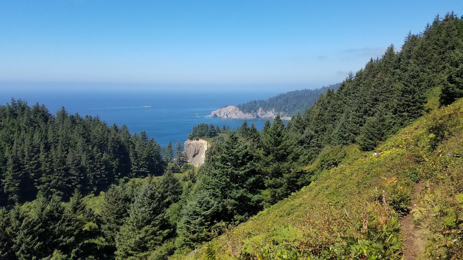
Neahkahnie Mountain has been on my list as long as I've had one. Tucked away south of Cannon Beach and located right on the south side of Short Sands Beach, providing a nice backdrop when you look at the cove from Cape Falcon.

There are two ways to the viewpoint at the summit, the south route and the north route. I was aiming for the shorter and easier north route, but google is very very bad at actually locating it and almost sent me up a gated logging road.

I ended up parking at a pull off lot on 101 that had a "Oregon Coastal Trail" sign on it. This ended up being the south trailhead. Well, a little bit longer, and a little bit harder, I'm okay with that. Since this wasn't my original goal, I wasn't even sure how far it would be to the top.

The trail up the mountain starts right across the highway. For the first fourth of a mile it switchbacks up through open mountain meadow with great views to the coastal cliffs. After that it plunges into the woods until the summit. The trail is steep but not too bad and most of the climbing is in mile 1. After it hits mile 2 the trail swaps from climbing the north flank to the south flank and has a few more long straight sections.

Neahkhanie Mountain from the coast

After hitting 2 miles I figured I was in for one more before hitting the viewpoint summit. I ran into a mother and daughter who asked me if I came from the summit. That was alarming. I shouldn't have been, because these two must have been blinder than bats, the viewpoint summit was less than a 10th of a mile past them and was cluttered with people, making it amazingly hard to miss. Yet miss it they did.

Climbing up the meadows in the first half mile

Cape Falcon in the distance


I climbed the rocky knob of the summit and was surrounded by at least 30 people. Sure, it was Labor Day Sunday during peak hours, but this was pretty crowded anyway and wasn't fun.

Summit of Neahkahnie

I took a few picks and went down to the trail, only to spot a side trail opposite the summit. It turns out there was a second summit to the east, and there was only 1 group of people on it. Not only that, but the view was even better! Outside being more exposed and dangerous, the east summit is better in every way.


Tiny people over a thousand feet below


The busy, inferior summit

I sat up there, alone, taking it in, laughing at the clusterfuck on the other summit. After a while I headed back down. I got back to the parking lot at just under 5 miles and was feelin' fine. Turns out, climbing Neahkahnie was just the first half of my day.

The trailhead also has a link to the Elk Flats trail, also part of the Oregon Coast Trail. It heads north, with a quick side hop to the Devil's Cauldron overlook .3 miles off the main track. It's a good overlook but not great, you never get quite the view into the cauldron (fancy cliff chute) you want.

Devil's Cauldron


Devil's Cauldron from other side

The wild blue nothing


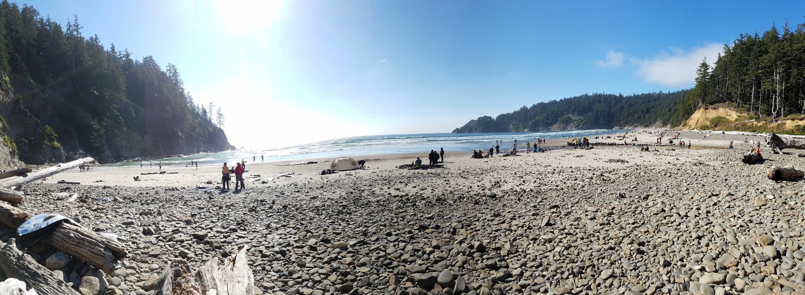
I went down the flats trail hoping for a side trail for a view of Short Sand Beach. I tried exploring a small game trail through the thick coastal brambles out to another rocky outcropping but got no view. After continuing along the Elk Flats trail I realized I was only a short hill above the beach anyway, so I just wandered down to the sand and sat there. Then I climbed the hill back up, weary and worn, and walked back to the car.


THE RESULTS
8.07 miles. 2300 Feet of elevation gain. Half of that was the mountain hike, half was the extra exploring.
The mountain itself is an easy hike, even from the "harder" trailhead I started from. If you are spending the day in this area, it's worth a couple hours of your time. The Elk Flats connection to Short Sands Beach was also easy and offers a few things to see. There was another side trail I could have checked out but was too tired for which might also offer a cliff view. Not a bad afternoon at all.